STOCK IMAGE
Auction Ended

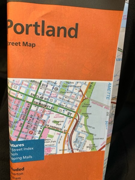
Rand McNally Folded Map: Portland Street Map
Sold
Brand New
QTY 1
$2.65
Last Update:
08/22/2025, 3:12 PM ESTItem Information
MSRP:
MSRP is a sample online retail price.
$0.00
Brand:
NA
Condition:
Brand New
Description:
Rand McNally's folded map for Portland is a must-have for anyone traveling in and around this part of Oregon, offering unbeatable accuracy and reliability at a great price. Our trusted cartography shows all Interstate, U.S., state, and county highways, along with clearly indicated parks, points of interest, airports, county boundaries, and streets. The easy-to-use legend and detailed index make for quick and easy location of destinations. You'll see why Rand McNally folded maps have been the trusted standard for years. - Regularly updated. - Full-color maps. - Clearly labeled Interstate, U.S., state, and county highways. - Indications of parks, points of interest, airports, county boundaries, downtown & vicinity maps. - Major attractions & Golf Courses. - Easy-to-use legend. - Detailed index & Major Street Index. - Convenient folded size. Coverage Area Communities Included: Beaverton, Gresham, Happy Valley, Lake Oswego, Milwaukie, Tigard, Troutdale, Tualatin, West Linn and adjoining communities plus downtown vicinity. Product Details: Measures 9.5' x 4' and folds out to 40' x 28'. Read more
Model:
9780528028816
Lot Code:
WBS3157109
Width:
4.2 inches
Depth:
0.3 inches
Weight:
0.1 pounds
Length:
9.0 inches
Additional Info:
Brand New
Pickup Location:
1825 Webster Street, Dayton OH 45414
Warehouse Location:
I10
Auction Number
WBS2503107